 Archeoplus
Gressy-Sermuz (VD)
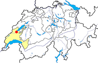
Canton: Vaud
Swiss topographic coordinates: 539'511, 178'601
OpenStreetMap: Sermuz
Google Earth file: Gressy-Sermuz-en.kmz
Documentation
Bibliography
- Le livre à remonter le temps (see Bibliography), p. 85
- Brunetti C. et al., Yverdon-les-Bains et Sermuz à la fin de l'âge du Fer, Cahiers d'archéologie romande 107, Lausanne, 2007
- Brunetti Caroline, Menna François, "Gressy - District Jura Nord vaudois", in Revue historique vaudoise, 2010, n° 118, pp. 321-323 (Online consultation, in the chapter "Chronique archéologique 2009")
- Curdy Philippe, "Le murus gallicus de Sermuz près d'Yverdon-les-Bains VD" in Archéologie suisse, 1984, 8, cahier 4, pp. 230-235 (Online consultation)
- Geiser Anne, "Yverdon-les-Bains (VD), Oppidum de Sermuz Sur Châtillon" in Genechesi Julia, Pernet Lionel, Les Celtes et la monnaie; des Grecs aux surréalistes, Gollion, Infolio, 2017, pp. 122-125
Links
- Sermuz: http://www.hls-dhs-dss.ch/textes/f/F11412.php
- Wikipedia - Oppidum de Sermuz: https://fr.wikipedia.org/wiki/Oppidum_de_Sermuz
Others visible sites in the area
- Chavannes-le-Chêne (VD): Roman quarry
- Molondin (VD): Medieval village of La Tour Saint-Martin
- Ursins (VD): Gallo-Roman temple
- Valeyres-sous-Montagny (VD): Standing stone
- Yverdon-les-Bains (VD): Menhirs, Roman castrum, medieval city (castle, museum)
The Celtic oppidum
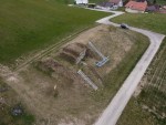
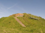
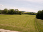
Originally, the rampart should have a length long enough to block the width of the hill and so, to protect a surface of approximately 7 hectares. The graves made on the site allowed to date the construction of the rampart at 50 BC approximately. The researches made on the plateau protected bay the rampart did not abble to determine precisely the function of the establishment. The most possible hypothesis is a military camp occupied during two generations.
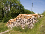
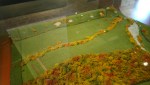
A section of the rampart, restored in 1990, allows to see the structure of the rampart with its wooden framework and its facings built with stones. A model of the rampart is visible in the museum of Yverdon-les-bains et région.
Swiss topographic coordinates: 539'381, 178'723
OpenStreetMap: Oppidum de Sermuz