 Archeoplus
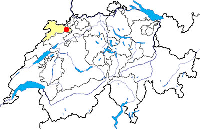
Vicques (JU)
Documentation
Bibliography
- Guide archéologique du Jura et du Jura bernois (see Bibliography), pp. 134-136
- Le Livre à remonter le temps (see Bibliography), p. 176
- Cardinaux Stéphane, Géométries sacrées, Editions Trajectoire, 2004, pp. 144-145
Links
- Villa romaine Vicques - Commune mixte de Val Terbi http://www.val-terbi.ch/fr/Visiter/Tourisme/Monuments-et-decouvertes/Villa-Romaine-Vicques.html
Others visible sites in the area
- Courgenay (JU): Dolmen
- Grandval (BE): Roads with ruts
- Moutier (BE): Medieval churches
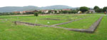
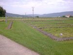
The Gallo-Roman villa
It is during the second part of the first century AD that a Gallo-Roman villa has been built at the spin of a fertile plain between Delémont, Courrendlin and Vicques. This villa has been excavated between 1844 and 1846, then between 1935 and 1938.
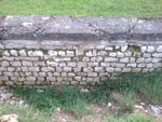
The first building of the pars urbana (residential part), built in stonework, had a U shape with a main wing, facing north and with dimensions of 32 metres by 10, and two wings, facing east and west, with a length of 16 metres. Then a fourth wing has been built to close the whole building. The main building was in a courtyard of 105 metres by 65, surrounded with a wall. Several buildings, including the baths, were place next to this wall. The pars rustica (rural part) has been partially dug up but not visible.
Nowadays, it is possible to see the main building of the pars urbana, whose foundations are protected by modern low walls, and an information pavillion has been built beside the remains the main building.
Swiss topographic coordinates: 597'733, 243'957