 Archeoplus
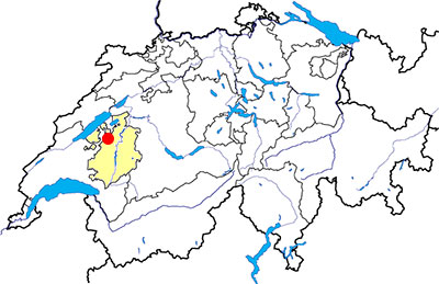
Montagny (FR)
Documentation
Bibliography
- Le livre à remonter le temps (see Bibliography), pp. 108-109
Links
- Castle of Montagny: http://www.montagny-fr.ch/2008/rubriques/histoire/chateau-de-montagny.php
Others visible sites in the area
- Avenches (VD): Roman city (amphitheatre, theatre, temples, baths, city wall, museum)
- Bas-Vully (FR): Celtic oppidum
- Gletterens (FR): Lakeside village
- Payerne (VD): Romanesque abbey church
- Vallon (FR): Roman villa (museum, mosaics), medieval church
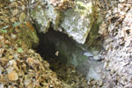
The Roman aqueduct
The valley of Arbogne has several sources, and one of them, called "Bonne fontaine" ("Good spring"), was the origin of an aqueduct built during the first century AD for the water supply of the Roman city of Avenches. This aqueduct was approximatly 15 kilometres long and its course was mainly underground. The surfaces of the canal are covered with a layer made of mortar with broken tiles and the upper part is constituted of a vault built with tufa blocks binded with lime mortar.
Swiss topographic coordinates: 566'337, 183'940
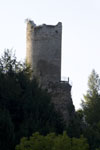
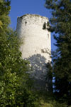
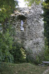
The medieval castle
On the top of a hill, it is possible to see the ruins of a dungeon built during the XIIIth century AD by the lords of Montagny. The site was already occupied during the XIIth century AD by a village and a castle. The castle has been transformed several times between the XVth and the XVIIIth century, before his abandonment in the XIXth century century and its transformation into a quarry for the inhabitants of the area. Since 1989, the castle is restored and the dungeon is fit out for the visit.
Swiss topographic coordinates: 565'983, 184'443