 Archeoplus
Gletterens (FR)
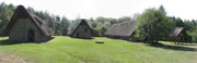
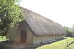
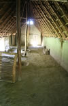
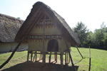
At Gletterens, on the side of Neuchatel lake, a lakeside village has been rebuilt near the modern harbour.
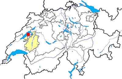
Canton: Fribourg
Swiss topographic coordinates: 561'789, 193'899
Google Earth file: Gletterens-en.kmz
Documentation
Bibliography
- Le livre à remonter le temps (see Bibliography), p. 78
Links
- Website of the lakeside village of Gletterens: http://www.village-lacustre.ch
Others visible sites in the area
- Avenches (VD): Roman city (amphitheatre, theatre, temples, baths, city wall, museum)
- Bas-Vully (FR): Celtic oppidum
- Payerne (VD): Romanesque abbey church
- Vallon (FR): Roman villa (museum, mosaics), medieval church
The lakeside village
A village of the neolithic period (about 5000 BC) has been dug up near the lakeside. Several buildings and a fence have been studied. Near the place where there were the remains of this village, three farms, a corn loft and a fence have been rebuilt since 1996. There is also a garden with the cultivated plants of the neolithic period. Various activities are regularly organized between April and October, such as animations for children or experimental archaeology.
Swiss topographic coordinates: 561'211, 194'719