 Archeoplus
Trélex (VD)
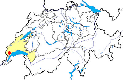
Canton: Vaud
Swiss topographic coordinates: 504'925, 142'730
Google Earth files:
OpenStreetMap: https://www.openstreetmap.org/node/240119560
Documentation
Bibliography
- Chautems Joëlle, Guide des hauts lieux vibratoires de Suisse romande (see Bibliography), pp. 122-125
- Keckeis Bastien, Itinéraire sacré: Au pied du Jura, de Bienne à Bonmont (see Bibliography), pp. 146-149
- Spahni Jean-Christian, « Les pierres énigmatiques de Grenolier et de Givrins », in Revue Historique Vaudoise, 59, 1951, pp. 49-55
Links
Other visible sites in the area
- Arzier (VD): Carthusian monastery of Oujon
- Cheserex (VD): Cistercian abbey of Bonmont
- Nyon (VD): Roman city (basilica, museum, amphitheatre, aqueduct, columns)
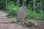
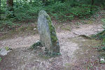
Menhir
In the wood on the west of Givrins village, but located on the commune of Trélex, a small standing stone is visible beside a pathway. Few informations are available about this 1.37 meter high standing stone, classified as historic monument. The excavations carried out in the early 1950’ allowed to prove the human origin of the monument , with stone blocks blocking the visible slab, but did not allow to date it. Several telluric phenomas are described in Joëlle Chautems ‘s book and also on the list of holy sites established by Stéphane Cardinaux.
Swiss topographic coordinates: 504'535, 142'609